Tales from the city – Derbyshire Life

Tales from the city

In an article written for Derbyshire Life “Tales from the city”, Jon Millhouse, a chartered town planner, member of the Institute of Historic Building Conservation and specialist in heritage and conservation at Planning & Design Practice Ltd, explores Derby’s industrial past.

Rivers have been central to our human story since time immemorial. They have given us water, food, protection, connectivity, trade and industry. They have determined the location and shape of our towns and cities.

Derby is no different. In fact, there are few stretches of water which offer as much historical interest, as the River Derwent through Derby. And yet, Derby has for many years turned its back on and ignored its river, despite it running through the heart of the city.

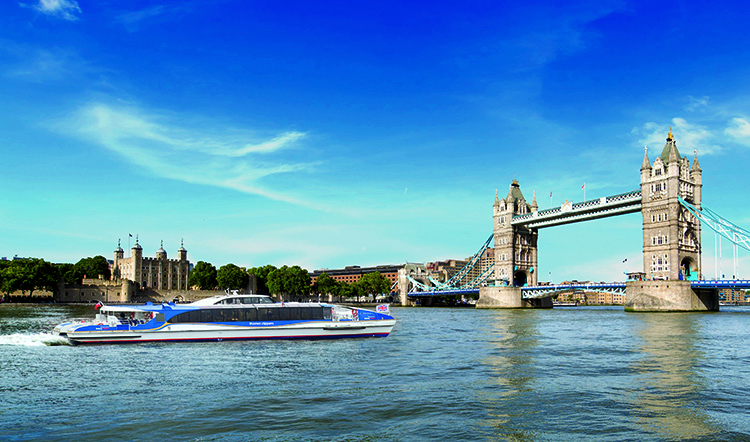
2021 is an important year for the River Derwent in Derby. It marks the 300th anniversary of the founding of the Derby Silk Mill, and the present building opens its doors to the public once again as a “Museum of Making”. It also sees a regular boat service return to Derby for the first time this year in decades in the form of a riverboat between Exeter bridge in the city centre and Darley Abbey Mills a mile upstream.

I decided to walk this fascinating route, to admire its buildings and bridges, and contemplate its history, interest, and intrigue.

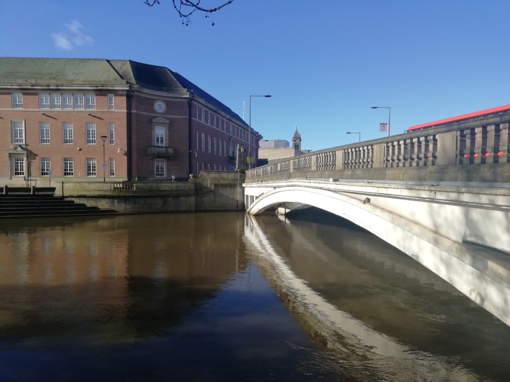
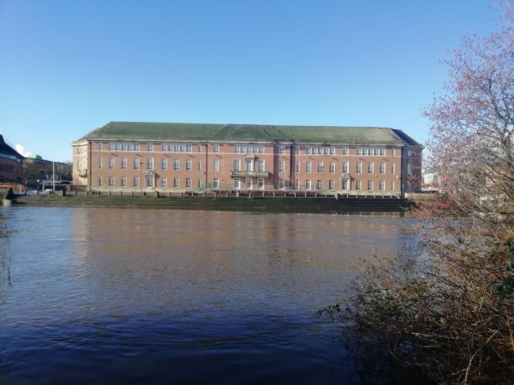
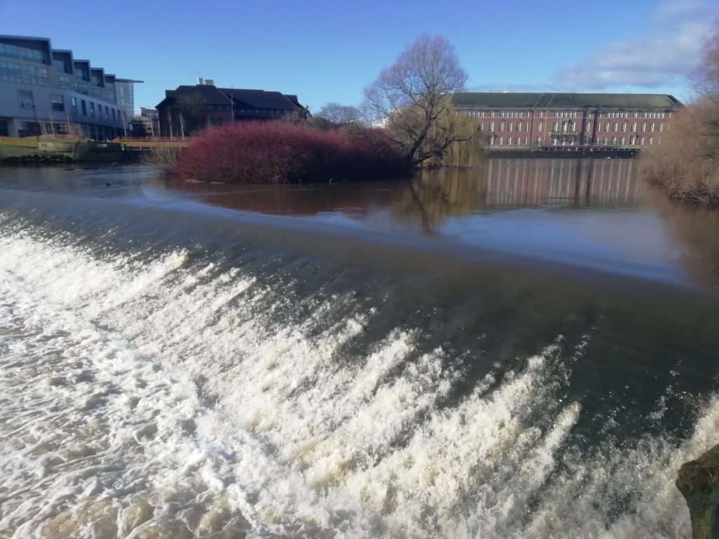
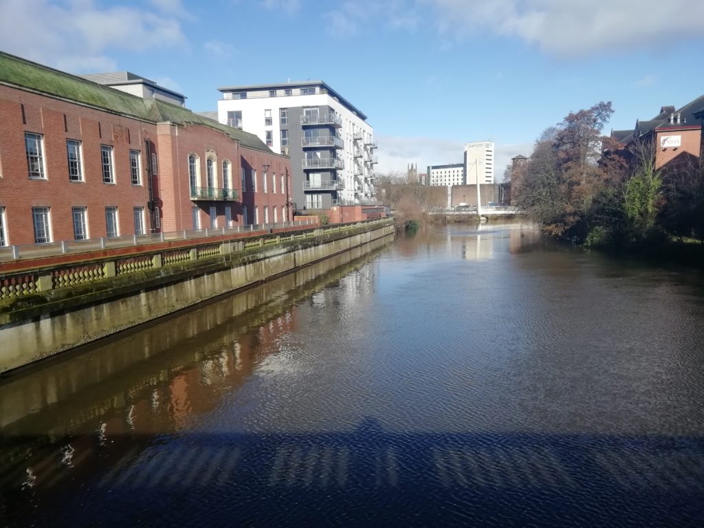
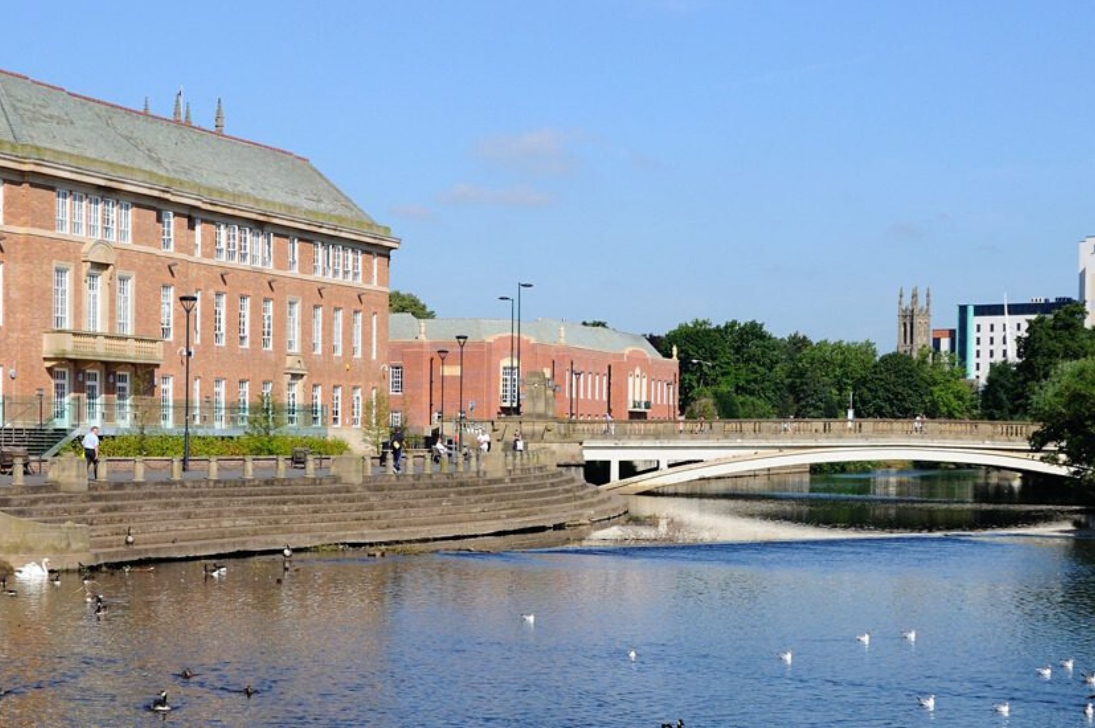
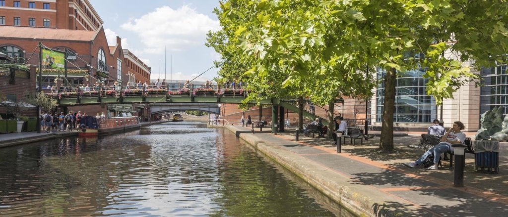
My journey starts beside the majestic Council House, an example of 1930s neoclassicism overlooking the little used and underappreciated river terrace. In front of the Council House the graciously curving river basin creates an expansive and calm body of water which looks as though it was created for picturesque, reflective effect, but was in fact like much else in this area a product of an industrial past.

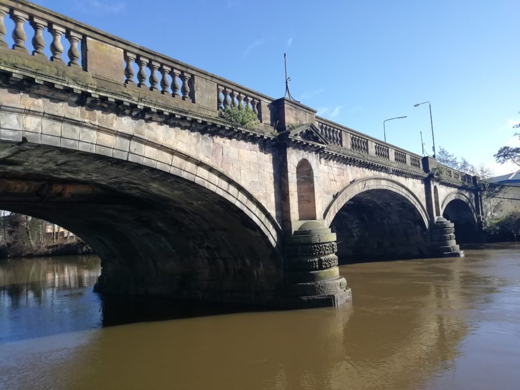
On the north side of the basin, the solid looking stone-built Exeter Bridge looks monumental and capable of withstanding a siege, as if marking an important crossing point, but is little used nowadays having been superseded by later concrete structures. The pillars of the bridge are adorned by motifs of local luminaries, Herbert Spencer, (Philosopher), Rasmus Darwin, (Physician, Botanist and Poet) and John Lombe (Founder of the Silk Mill).

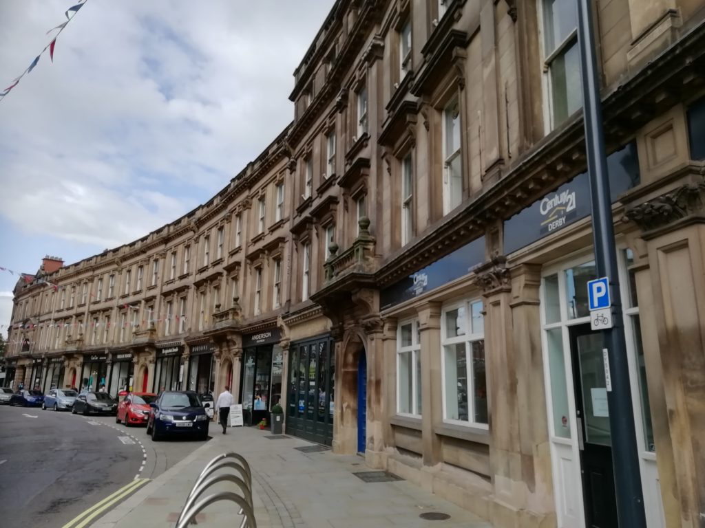
On the eastern bank is Exeter House, an attempt at a modernist apartment block, with its “streets in the sky” balconies and communal green space overlooking the river. But with it’s bright red front doors and chimney pots it is not the purest example of modernism -more Leytonstone than Le Corbusier!

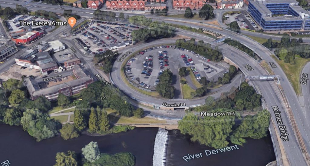
The Council House, Exeter House, magistrates court and adjacent roundabout were all part of the 1931 central improvement plan by Derby Council Architect Charles Herbert Aslin. It is ironic that the roundabout -a feature beloved by mid-twentieth century municipal planners -survives as an ornamental centrepiece despite having little practical use given traffic restrictions on nearby roads. This was an era when the confidence and power of the urban planner was at it’s peak. The old world boldly swept away to be replaced with new ways of living and working.

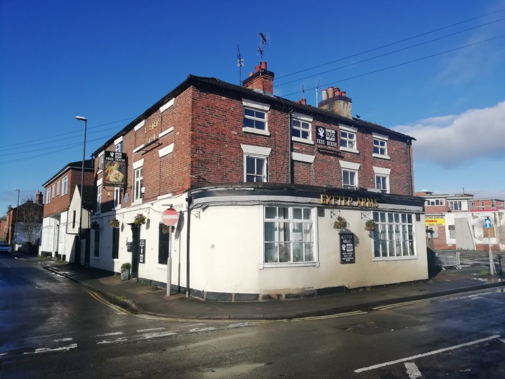
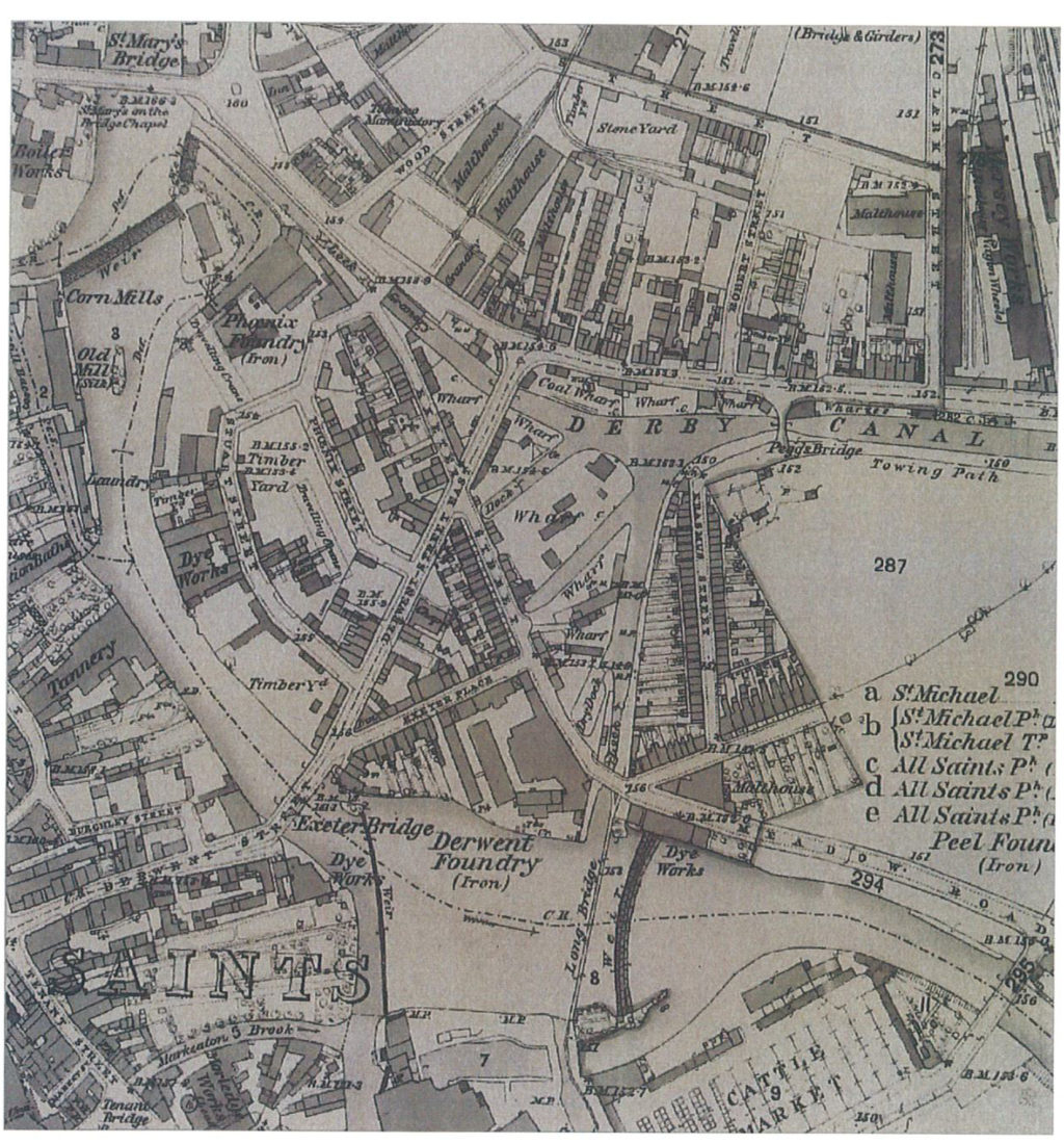
North of the river there is a forlorn looking piece of land sandwiched between the river and the monolithic ring road known as ‘North Riverside’. Earmarked for redevelopment projects for years which have never quite happened, it now seems disjointed and unloved. Look at a late 19th century map however and a very different picture is painted -one of canal docks, wharfs and tightly packed terraced housing. You can almost imagine the hustle and bustle of the dockyards, kids in rags playing by the canal, and thirsty workers drinking in the pubs and fighting in the street. The Exeter arms survives as a remnant -if only its walls could talk!

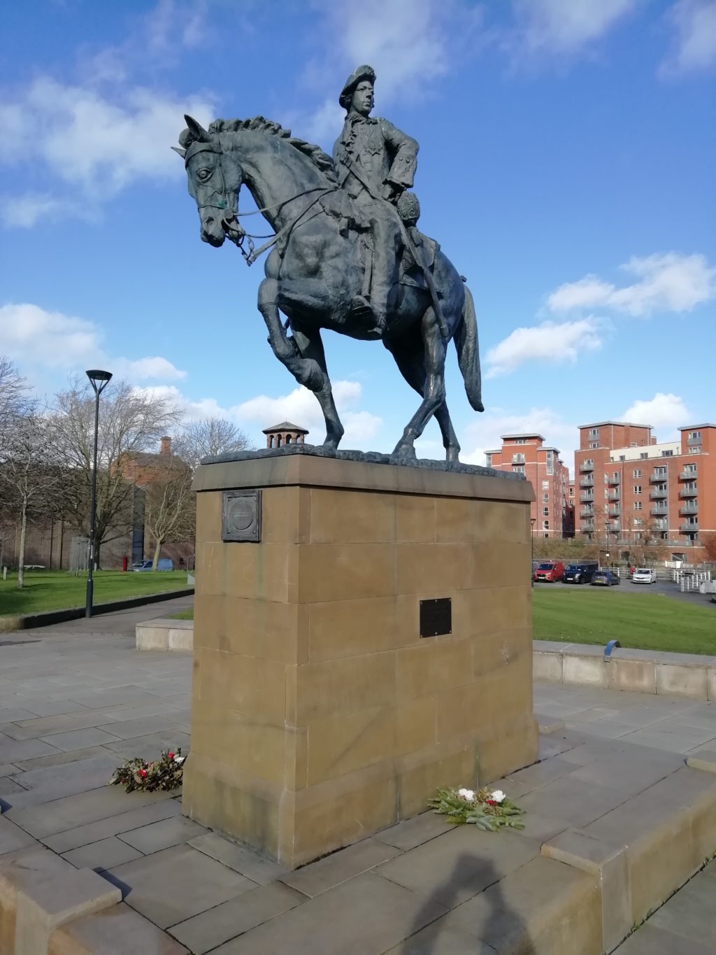
Beyond Exeter Bridge a newly built Premier Inn hotel overlooks the river on the site of what was once a grand townhouse known as Exeter house, where bonnie Prince Charlie famously signed documents to concede the retreat of his invading Jacobite army in 1745. The prince travelled through Derbyshire on route to London not because he was anticipating a Premier Inn, but because he was anticipating the people of Derbyshire to be sympathetic to his cause and willing to take arms and join the march South. It is hard to imagine Derbyshire as a hotbed of Scottish nationalist fervour -unless perhaps Scotland do well in the European football championships this summer.

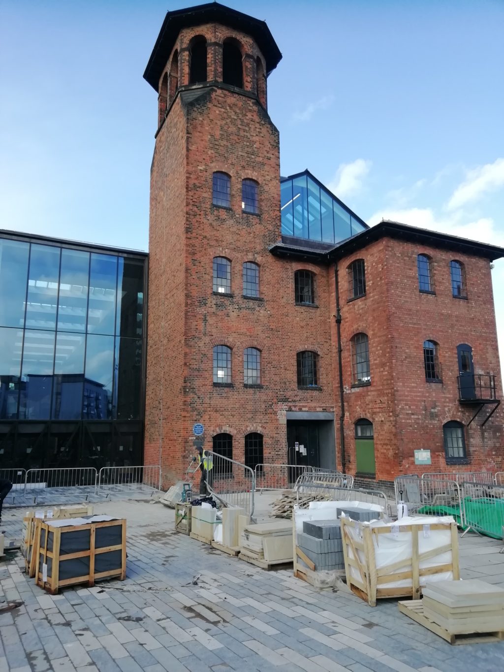
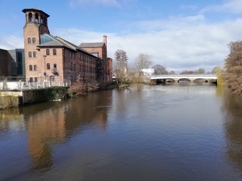
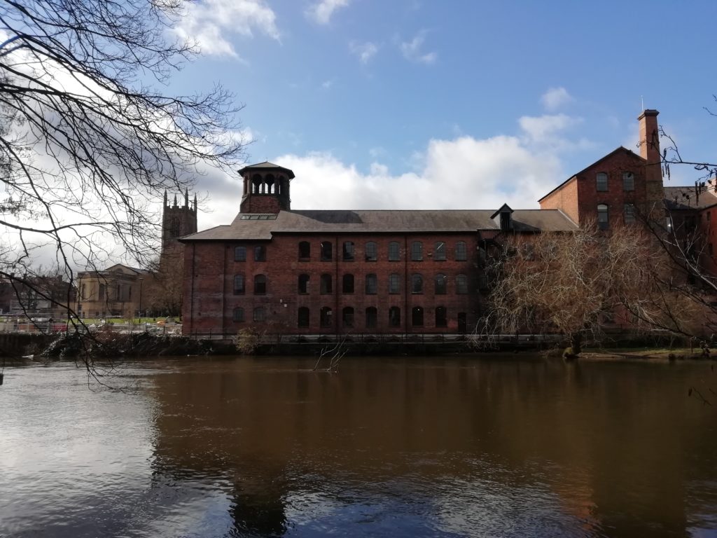
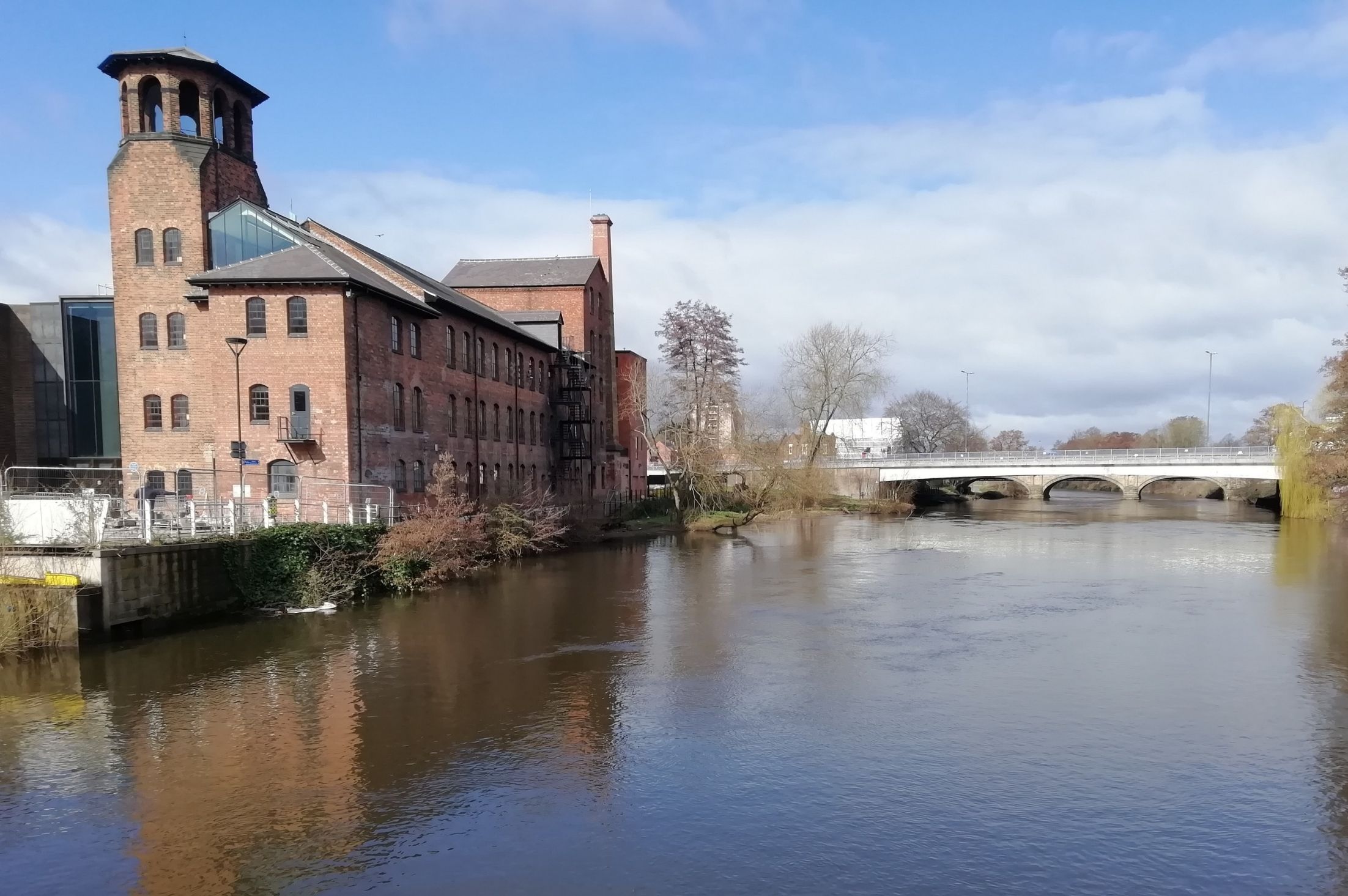
A modern footbridge affords a pleasant view of the famous Silk Mill, a rebuild of the original mill constructed between 1718 and 1721 for John Lombe. Revolutionary in its day for its scale and use of technology, Daniel Defoe, author of Robinson Crusoe, famously visited Derby in 1720 and stood in awe at the sight of it. The Silk Mill is considered by many to have been the world’s first factory, yet until very recently it was less celebrated than Arkwrights and Strutts Mills further up the Derwent valley at Cromford and Belper. Granted, the present Silk Mill building is a rebuild (although remnants of the original survive beside the river), but the Silk Mill was a good half century earlier than its more illustrious neighbours. It also has the added benefit of a Hollywood-esque spy story. Italian authorities reputedly sent an assassin to kill John Lombe for industrial espionage, having himself apparently stolen silk throwing secrets after a visit to Piedmont. Lombe dies suddenly in 1722. It is good to see the building having finally undergone restoration and transformation into to a public museum, the new Museum of Making, part of the Derby Museum portfolio.

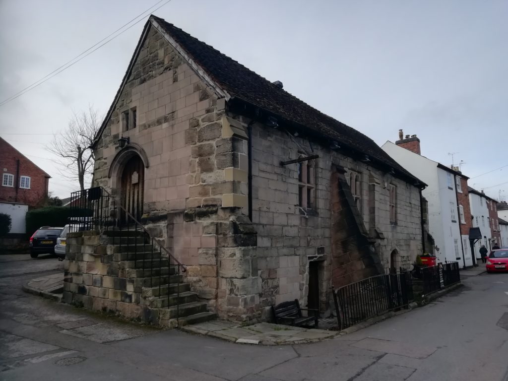
Another building which is undervalued, and overdue restoration is St. Mary’s Bridge Chapel. One of only a handful of its type in the country, the mediaeval bridge and chapel present an evocative riverside vista, celebrated in 19th century paintings but now sadly dominated by the thousands of vehicles rumbling passed daily on the concrete flyover built in the 1970s just feet away.

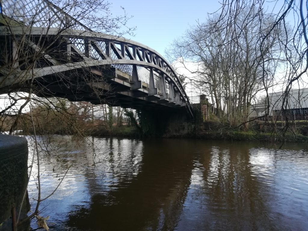
On past the remnants of old Victorian factories and foundries, developed when Derby was the workshop to the world and supplying materials for notable buildings such as Bombay Pier and London’s Albert suspension bridge.A symbol of the brute strength and power of the area’s industrial past survives in the form of Handyside Bridge, a stout but nevertheless gracious iron bridge, once taking steam engines but now enjoyed by pedestrians.

To the west is Strutts Park, a pleasant suburb of late nineteenth/ early twentieth century houses, some in the arts and crafts style, on the site of the original Roman settlement in Derby.

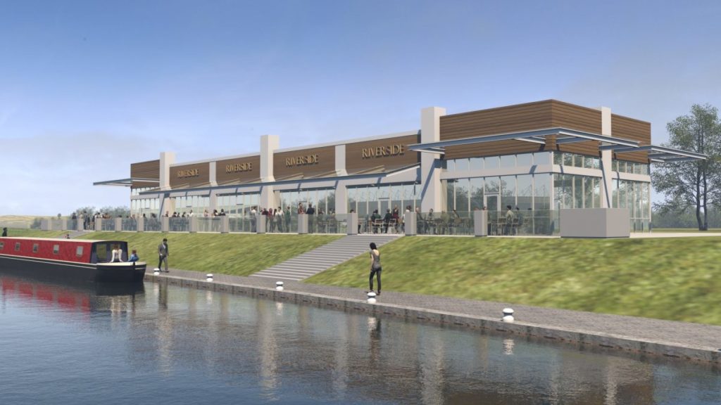
Into Darley Park, a wonderfully attractive green lung, made more accessible by a recently constructed riverside path. This is classic English parkland from the old Darley Hall, gracefully sweeping down to the river and framed by specimen trees. The hall is long gone but its terrace survives as a cafe, offering a celebrated view back to the cathedral -if only the tower of a recently built hotel didn’t jostle for your attention.

On the opposite side of the river is the suburb of Little Chester, so named in recognition of it being the location of Derby’s second Roman settlement -Derventio. Remnants of the Roman settlements were recently uncovered in an archaeological dig which preceded the construction of a flood defence wall. The wall was then rather pleasingly built to follow the original perimeter wall of the Roman fort, complete with pillars to mark the entrance and narrow Roman style bricks.

The Evans family who built Darley Hall made their fortune from cotton spinning in the adjacent Darley Abbey Mills. The associated workers community survives today as a much sought-after London style ‘urban village’. Clusters of former millworkers cottages exist as if in a time capsule. Once a place of overcrowding and hard, gritty lives I’m sure, but today quaint and benign.

A remnant of the Cistercians Abbey which predicated the mill still exists as a popular drinking establishment, albeit currently closed.
Over the river the mill complex itself is a hub of activity -creative businesses, studios, artisan eateries, local people milling about.

Here the river boat -and this particular walk- terminate. A short stretch of river but 2000 years of history and much to admire

“Tales from the city” was originally written for, and appeared in Derbyshire Life – Volume 90 Issue 7, July/ August 2021

Re-embracing Derby’s waterways

PDP_Derby's waterways

Impressed by the Derby and Sandiacre Canal Trust’s plans to restore and develop The Derby Canal, Chartered Town Planner Jon Millhouse, of Derby-based Planning and Design Practice, offers a few ideas of his own for re-embracing Derby’s waterways and achieving a waterside renaissance in the city.

“I recently attended a presentation by the Derby and Sandiacre Canal Trust in which they outlined their vision to reinstate parts of the old Derby Canal, build a new marina and boat lift at Pride Park, and run a riverboat along the Derwent between Exeter Bridge and Darley Abbey Mills.

I applaud the Trust’s ambition and wish them every success. If their plans become a reality, and the city centre becomes navigable once again by boat, this could be the catalyst for further water-based projects in Derby, allowing the city to re-embrace its waterways in a way it hasn’t done for 100 years, but in a manner suited to the challenges and opportunities of the twenty first century. I outline below some ambitious ideas of my own for the city’s waterways.

1: A Riverbus

A riverbus, of the type which runs along the Thames in Central London, could ferry commuters, shoppers and visitors along the Derwent from the northern to the eastern outskirts to the city centre. Derby lacks a tram system like Nottingham’s but this would provide an unusual and enjoyable alternative. Admittedly, it may not be the quickest way to travel, but personally I would be prepared to add a few minutes to the daily commute to my office in return for as pleasant journey along the Derwent! With major infrastructure works soon to commence on the A38 (and associated traffic disruption likely to follow) and people increasingly looking for more environmentally friendly ways to travel, a riverbus could be an attractive proposition.

2: Re-creating a city centre dock

The Derby canal once terminated in a large dock, in the North Riverside area between the River Derwent and Nottingham Road in the centre of Derby, now occupied by the Darwin Place car park and car lot. Historic maps show wharfs, cranes, foundries and terraced housing surrounding the dock – it must have been a hive of activity in its day.

If the Canal Trusts plans to build a boat lift at Pride Park become a reality, this would allow boats to navigate from the national canal network as far as the weir in front of the Council House. The Darwin Place car park could be transformed into a modern day dock, accessed via a lock on the River Derwent. This could be cross-funded by the development of waterside offices and apartments, creating a mini London docklands in the heart of Derby!

3: Re-opening the Markeaton Brook in Derby

The final kilometre of the Markeaton Brook before it reaches the Derwent, now runs in Victorian-built culverts beneath Sadler Gate Bridge, The Strand, Victoria Street and Albert Street. Re-opening this waterway would breathe new life into these historic streets. Imagine the graceful curve of the Strand terrace facing (and being reflected by) water rather than tarmac. Imagine a waterway running down the centre of Victoria Street, overlooked by landmark buildings such as the Old Central Post Office and the HSBC bank, flanked by cafes and pedestrian walk ways, and crossed by an Amsterdam style arched bridge as its junction with Cornmarket and St. Peter Street.

Such an operation would not be easy, but if Victorian engineers could manage to put an entire water course inside a tunnel, surely it is not beyond our capabilities in the 21st Century to ‘take the lid off’ again. The cost of such infrastructure works would be re-paid in time by an increase in property values and economic activity brought about by an enhancement of the city centre environment.”

Historical map of Derby city centre

Recent Flooding

PDP_Recent Flooding

Recent heavy rainfall resulted in numerous flood alerts being issued across Derbyshire, and South Yorkshire and the weekend saw the River Derwent burst its banks, with the resultant flooding causing travel chaos, widespread disruption and a tragic loss of life.

Derbyshire was hit with more rainfall in 24 hours than it normally receives in a month. The Environment Agency’s gauge in Glossop, a market town on the edge of the Peak District, recorded 114mm of rain in the 24 hours up to 4am. On average Derbyshire receives 90.7mm of rain during the month of November.

This is just months after the evacuation of the Derbyshire town of Whaley Bridge, when thousands of residents were evacuated amid fears a dam could collapse after being damaged by floodwaters.

Heavy rainfall saw concrete panels on one side of the dam on the Toddbrook Resevoir, which holds 300 million gallons of water, partially collapse, creating a crisis that has cost Derbyshire County Council in the region of £700,000.

At the height of the situation, a Chinook helicopter from RAF Odiham, was engaged for a combined 72 hours over several days to drop more than 600 tonnes of aggregate on the damaged dam to prevent it breaching.

In a report published in May 2018, the Royal Institute of British Architects (RIBA) state that the government needs to do to help create homes and communities that are resilient to flood damage. In the report, titled “The Value of Flood Resilient Architecture and Design” RIBA stresses that the UK can no longer base its approach to managing flood risk on simply keeping the water out, and highlights the following statistics:

  • Currently 1 in 6 homes in the UK are at risk of flooding – a number that is expected to double by 2050
  • Flooding causes an average of £1.4 billion of damage each year to businesses and households

Meanwhile a new report from the Royal Town Planners Institute (RTPI) has said that sustainable drainage systems (SuDS) are not being delivered at either the pace or scale that is required to cope with the challenges posed by climate change.

The systems are considered an important way of managing surface water runoff in built developments. National planning policy has encouraged their use in all major developments since their introduction into the English planning system in 2010.

However, 96% of local authorities report that the quality of planning submissions for SuDS are either ‘inadequate’ or ‘mixed’. Furthermore, 25% of local authorities have no formal SuDS policies in place, nor any immediate plans to implement any.

According to officials at Derby Council, closing the flood gates at Haslam’s Lane and Darley Fields for the first time saved around 1,140 homes from flooding in the Chester Green and Darley areas during the recent deluge. The gates are part of the city’s £95 million flood defences – part of which are still under construction.

Whilst the successful implementation of the flood defences offers reassurance, with more heavy rainfall forecast, the Council, together with home, business and landowners will be anxiously watching the weather forecasts as we head into the winter months.

“As the effects of climate change become even more apparent new development must become more robust. Land use has a big part to play. The flood allowance for climate change has increased over the past 10 years and the Environment Agency is looking to raise the figure further said Jonathan Jenkin, Managing Director of Planning & Design.

“As one in one hundred year flood events become common place, locations which we thought would not flood are now flooding. This means that we must have effective surface water run-off measures in place to hold surface water in new developments to prevent run-off adding to flooding elsewhere.

As planners we should avoid building vulnerable developments on floodplains such as housing but in some locations whole towns are liable to flooding. In locations such as this house building needs to take into account flood risk and be built to allow for and accept flooding.

For the government, the wider strategy for climate change resilience must include changes to land use including reforestation of the uplands, retrofit and new build development to zero carbon, a major shift from car use to public transport and a national policy for flood protection, with a national debate over the costs and the benefits of maintaining settlements and communities liable to regular flooding by rivers and near to the sea.”

GET IN TOUCH